Wales Arts Review is proud to present this unique insight into the work of CHERISH, an EU-funded project which is collaborating with landscape artists Pete Monaghan and Julian Ruddock to increase knowledge and awareness about the impacts of climate change on the Welsh coastline.
The constantly changing landscape of the Welsh coast has a long history of human interaction and habitation, as well as continual erosion by the natural forces of wind and waves. An ambitious EU-funded project, titled CHERISH (Climate, Heritage and Environments of Reefs, Islands and Headlands), is concerned with increasing knowledge about the impacts of climate change past, present and future on the archaeological record and landscape history of the coastline.
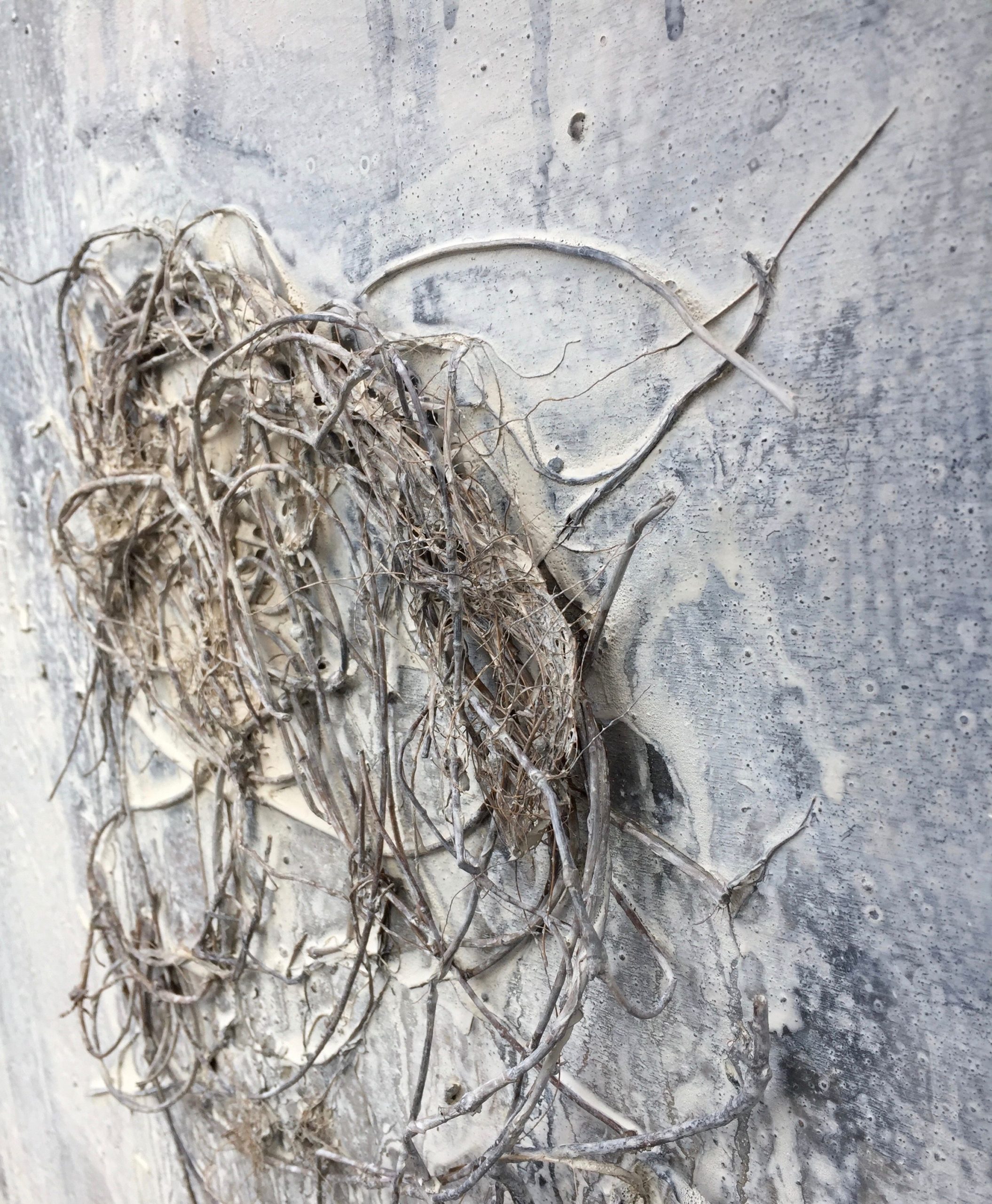
Julian Ruddock Pen y Cyfwy: Cliff face, St Non’s Bay (2019)
Two artists, Pete Monaghan and Julian Ruddock are using the stimulus of the remarkable imagery, archaeological artefacts and interpretations of human narratives as material to inspire their work as landscape artists. Monaghan and Ruddock share an interest in the ceaseless changeability of the marine environment. They interpret the scientific information and images that reveal change over time, responding to the immediate, subjective and felt experiences of place, weather and environment. While their methodologies as artists differ, they share a common understanding and love of painting, a similar preference for tonal images and, in lively conversation, an appreciation of certain painters that inspire them.
The CHERISH science team, involving both the Royal Commission on the Ancient and Historical Monuments of Wales (RCAHMW) and Aberystwyth University’s Department of Geography and Earth Sciences, brings together archaeologists, geomorphologists, palaeoecologists and geochronologists in an interdisciplinary project that aims to provide a baseline record of important archaeological sites and heritage at risk on the coasts of Wales and Ireland. The research addresses the relevance of the coast in our collective past, an urgent task in the face of climate change, the impacts of which are becoming apparent in rising sea levels, flooding, increased storm events and erosion.
The science team employs a range of methods to reveal the palaeoenvironmental history of coastal landscapes. These include analysis of sediment cores, photogrammetry, aerial photography and the use of drones to capture stunning perspectives of the coastline from extreme vantage points. These technologies offer the possibility of observing change in the dynamics of the coastline over time, particularly when linked to similar surveys that have taken place in the past. Their work investigates questions around why our ancestors chose to live in these marginal and precarious locations and the possible functions these settlements fulfilled.
CHERISH: Art and science interacting
Incorporating visual arts into the interdisciplinary, science-based research complements and adds further interpretation of the significance of coast within culture. The value artists bring to such projects is seen today in many recent art-science collaborations, often providing an alternative perception of research findings, and reinterpreting the remarkable scientific imagery that goes beyond human visual faculty.
The artists have engaged with the CHERISH project in differing ways and enjoy the opportunities it has brought to compare approaches to landscape representation. Monahan is concerned with human habitation and travel within landscape, both the contemporary building vernacular and the journeys taken across the Irish Sea. Ruddock, likewise, is interested in the vestiges of human habitation that are scattered along the Welsh coast and the interaction of people and environments. The landscape and islands of Pembrokeshire, specifically the coastline around St Davids, have been the subject of his work for many years. More generally, his research background is in the collaboration between art and science in relation to climate change and the artistic use of science-derived images of environmental change.
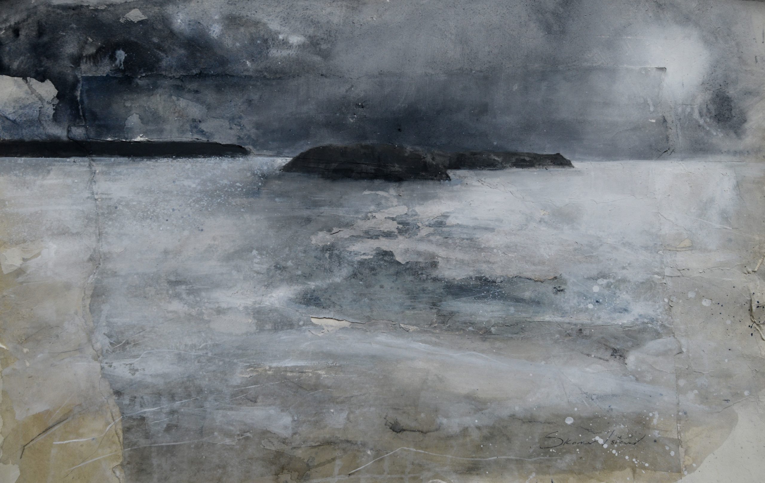
Julian Ruddock Skomer (2018)
The artists’ experiences
Although neither artist would describe themselves as plein air painters, drawing and painting on location is a necessary initial practice used by both artists to gain a sense of a place, its character and compositional possibilities. During the period of research, Monaghan and Ruddock visited islands and historic coastal sites in Pembrokeshire as well as coastal forts such as Dinas Dinlle, near Caernarfon, while interacting with the science team. Sketches, photographs and information gained from these experiences then inform the painting and drawing processes in the studio.
Monaghans’s visit to Dinas Dinlle on the Llyn Peninsula is a good example of how a location can inspire an artist. His thoughts on his visit provide insight into his working methodology:
I see our artistic interpretation of the CHERISH project as an opportunity to work outside my comfort zone. Frankly, I was struggling to find a way to do justice to the aims of the project and its exciting findings until my trip to Dinas Dinlle. Arriving late afternoon on a winter’s day I was greeted with a spectacular sunset to lift the spirits. Here was a layered landscape with a prominent hill around 7000 years old, surmounted by the Iron Age Fort around 2500 years old, and cliffs being eroded as I watched. The ancient sites stood in stark contrast to the brash fish and chip shop with garish signage and some public toilets (approx. 50 years old!). Excited by the palimpsest of human interaction within this landscape I set to, sketching incessantly for 2 days.
To my right was the Irish Sea, in front the hills of the Llyn Peninsula, left: flat bogland with flocks of Lapwings and Golden Plovers, further left: the mountains of Snowdonia, in the foreground: some grubby cottages fighting for survival against the constant threat of flooding. A raw and brooding landscape, nectar for an artist.
Back in the studio the line drawing sketches, along with invaluable priming from scientists in the lab and field, informed my work as I began working into large-scale paintings, allowing myself the freedom to re-interpret colours and textures. I took some mud from the eroding cliff-face along with sand and seaweed from the shore to use as collage; challenging, but fun!
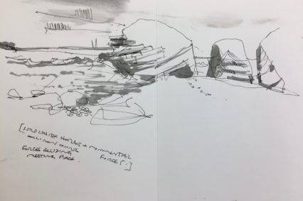
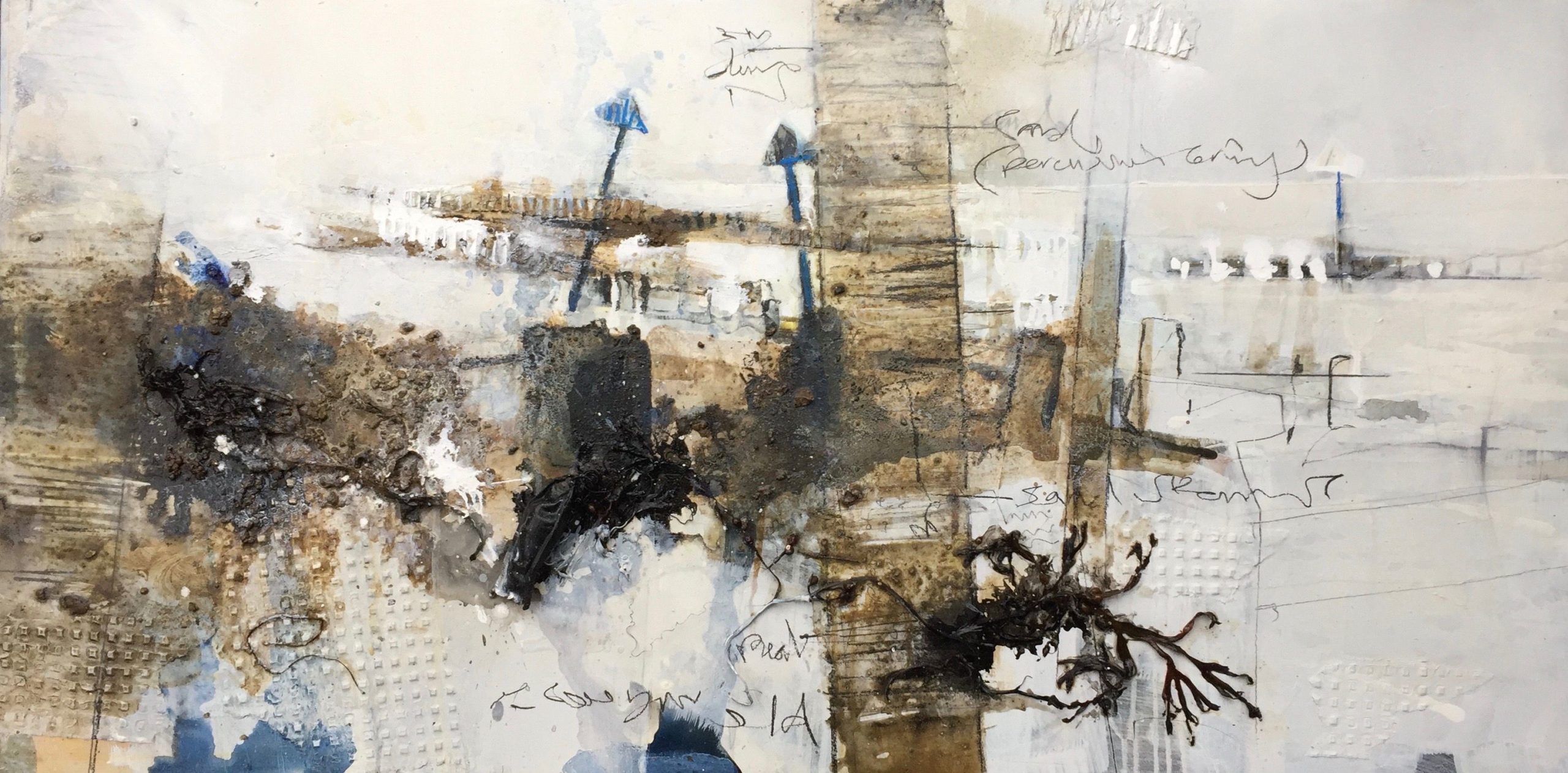
Pete Monaghan Sketches
As Monaghan works up his sketches on larger surfaces, with dribbled paint and scribbled marks, his addition of layers adds more information about what the artist has observed, a complexity of line and texture, both descriptive and highly expressive.
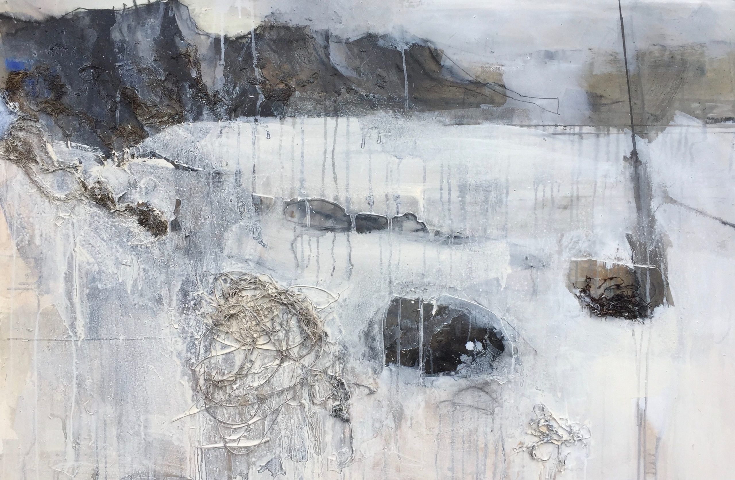
Pete Monaghan Dinas Dinlle (2021) | CHERISHPete Monaghan Detail of material used in Dinas Dinlle (2021) | CHERISH
The ‘submerged forest’ at Borth, Ceredigion, provided another fascinating site for the artists to respond to. Here, stumps of 6000-year old trees emerge periodically from the sand, remnants of the woodland that once extended far out onto land now submerged beneath Cardigan Bay. They are graphic reminders of how mutable coastline is, subject to vast changes in relatively short spaces of time. The village of Borth, situated on a coastal spit between the sea and the bogland of Cors Fochno, is at risk of future inundation from rising sea level, as are other communities along the coastline.
Pete Monaghan Borth (2021)
The beach at Borth and Ynyslas, with its weathered groynes, shifting sand dunes and pebble storm beach, provides a subject for both artists; they have worked there in different ways. Monaghan uses perspective to convey the unfolding space as seen by someone on the shore, integrating maps, scribbled marks and vestiges of human existence. Ruddock, by contrast, adopts an aerial view.
Julian Ruddock Borth (2020) | CHERISH
Ruddock provides an altered perspective of land and coastline and in doing so follows in the tradition of many landscape artists of the past. Viewing the earth from above – elevated and released from ground-based perspectives – was a practice of Peter Lanyon (1918-1964), an important St Ives artist and glider pilot, who adopted this ‘birds-eye view’ in the 1950s to create unconventional images of the Cornish coastline. For Lanyon, such aerial views opened up the possibilities for abstraction, as landscape seen in this way subverts convention, lending itself instead to a flattened picture plane and concern for organisation of form, space and colour.
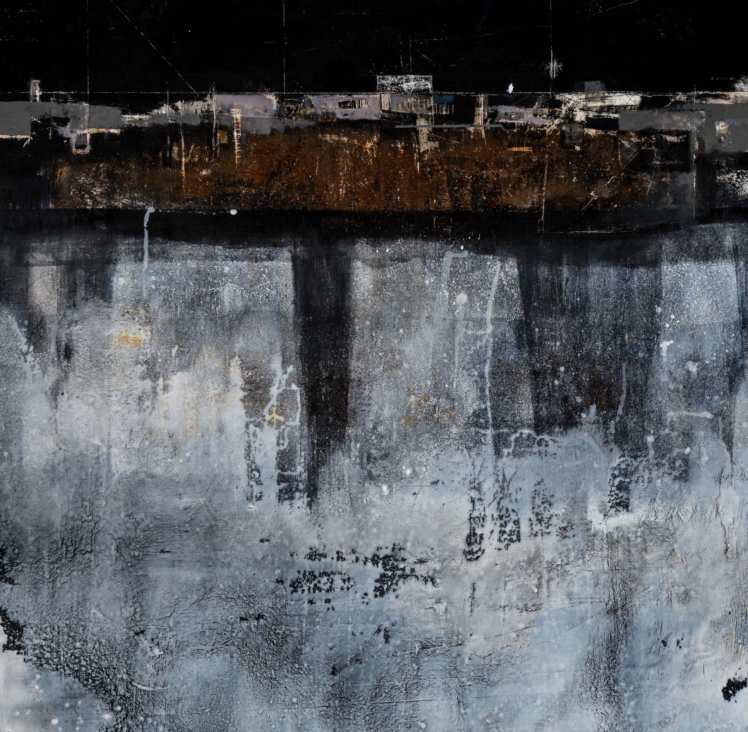
Julian Ruddock Inundation (2019), based on original Crown Copyright RCAHMW.
CHERISH | Artistic interpretation of scientific imagery
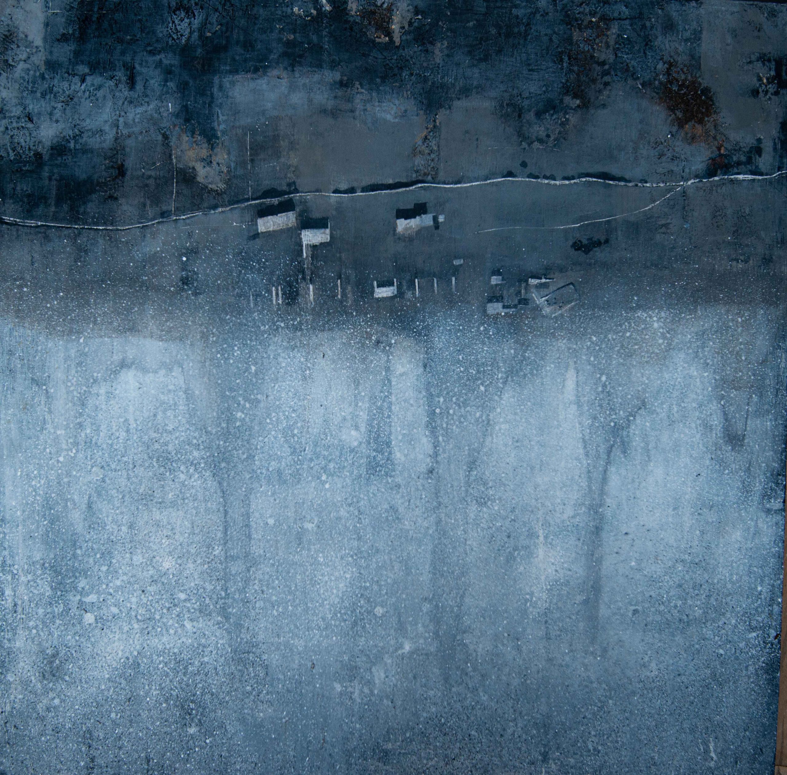
Ruddock is fascinated with the altered perspectives provided by aerial views and has used both the remarkable photographs provided by Dr Toby Driver, (Senior Investigator, Aerial survey at RCAHMW), and the potential offered by new remote sensing technologies for artistic purposes. His image, Inundation (2019) depicts the remains of buildings and habitation along the Pembrokeshire coastline, the encroachment of the sea and the tracks and trails of human activity. As an image it reveals his interest in the ability of our twenty-first century technology to observe, scrutinize and monitor the earth surface and past human activity.
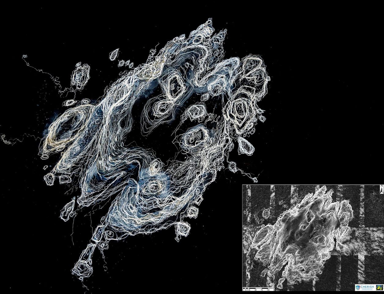
As well as aerial photography and drones, the investigation of the landscape involves using LiDAR, a system of optical remote sensing technology that works by measuring the distance to any given object or surface by hitting the target with light in the form of pulsed laser. Through this means a complex and precise map of terrain can be established that strips away vegetation and reveals previously invisible layers of the ground surface. The LiDAR images have been used by Ruddock in drawings such as Grassholm (2021) in which the remote Pembrokeshire island, populated by thousands of gannets in the spring and summer, is shown in line form, the geomorphology revealed in all its complexity like the contour detail of a traditional map.
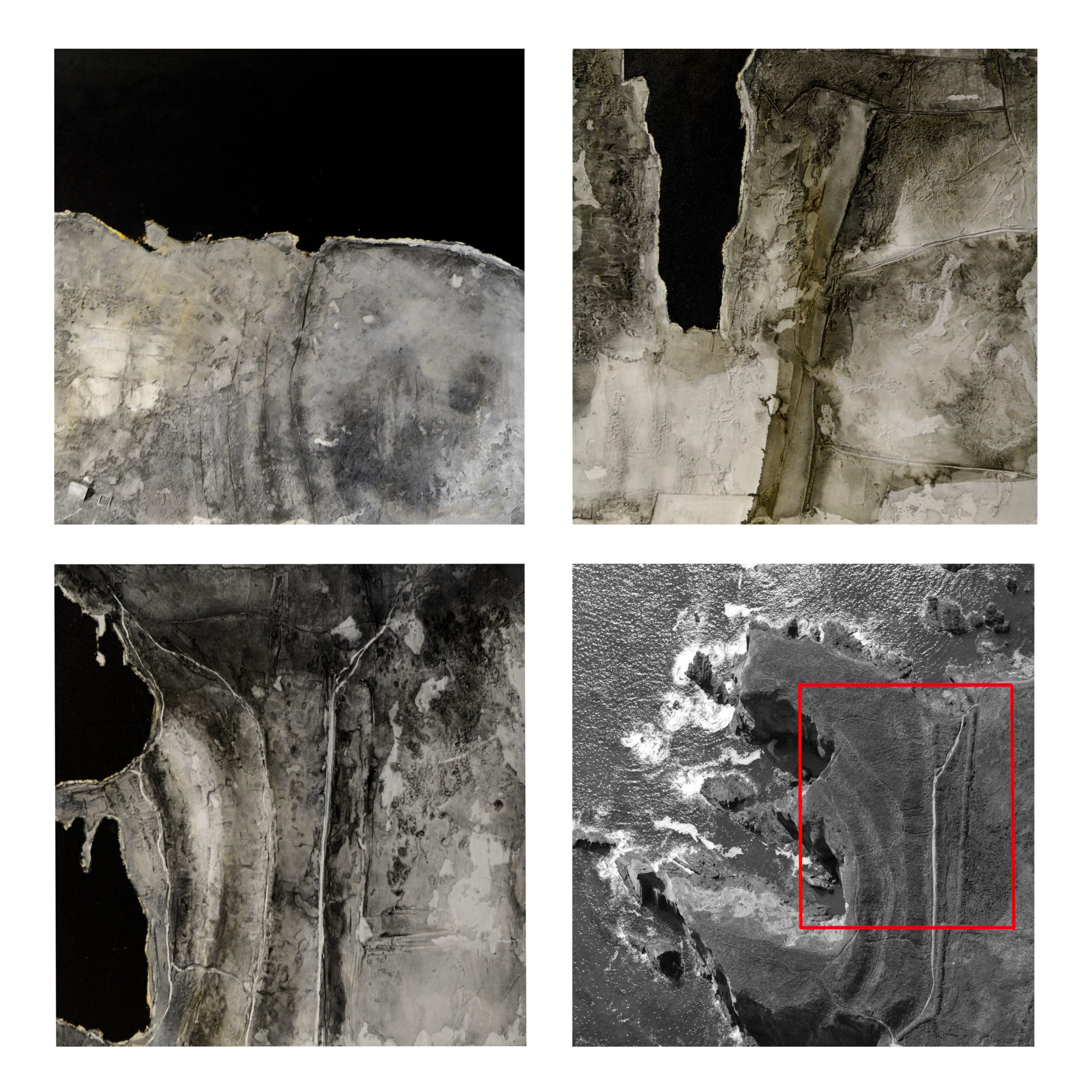
This revolutionary scanning technology is enabling archaeologists and geomorphologists to observe terrain where habitation, agriculture and field boundaries exist but are no longer easily visible from the ground. Visible as marks on the land surface, these evidential scars and records of human impact in the past influence the marks that Ruddock produces in series such as Coastline (2021). These images of habitation and coastal promontory forts are produced through a process of addition and subtraction of oil paint and plaster, underlying layers revealed through repeated abrasion; a visual archaeology conducted with paint rather than earth. Ruddock is interested in the illusion and mimicry of earth surface that can be achieved in paint and also in the relationship between photographic source and painted surface. From the original data source the painting takes on a life of its own, becoming a palimpsest of marks alluding to natural processes of erosion and accretion; a history of both its making and the place.
Julian Ruddock, Coastline (2021): 1. Ruins of a priory on St Tudwal’s Island East, 2. Skomer Island fields and boundary marks, 3. Porth Y Rhaw and 4. Original photographic source of Porth Y Rhaw, courtesy RCAHMW Based on Crown Copyright RCAHMW
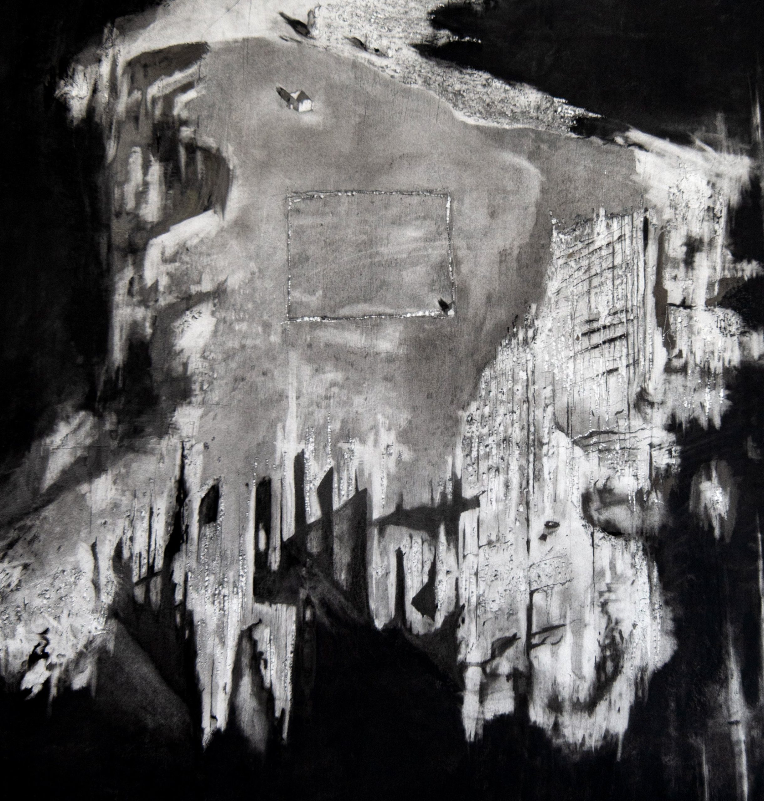
Scale and birds-eye perspective similarly inform drawings such as that of the promontory fort at Flimston Bay, known locally as ‘The Cauldron’. The iron-age settlement is depicted within the wider context of the Pembrokeshire coastline with its eroded cliffs and collapsing central sections, exemplifying the extreme locations in which our ancestors lived. Settled for the availability of resources as well as for the natural defences they offered, these remnant promontory forts are powerful reminders of coastline change and human endurance in surviving in such extreme locations.
Julian Ruddock Flimston Bay (2019). Based on original Crown Copyright RCAHMW.
Through the process of translating the image from aerial photographs into a highly detailed, large-scale drawing, the artist gains experience of each rock and fissure, in a sense ‘inhabiting’ the landscape. Both the original site visits, and the extended time such drawings take, allow reflection on lives lived in such places, and for the artists to investigate the form and structure of the landscape geomorphology. In a sense, drawing and painting act as a means of personal knowledge acquisition about a complex landscape in flux.
Julian Ruddock Caldy (2020). A large drawing of St Margaret’s Island, again from an aerial photographic source, depicts chapel ruins and an enclosed field on an isolated rock. Here the erosion of the rocks has produced a ragged and stratified shelf, depicted in charcoal and graphite resulting in a densely worked and scarred surface. Based on original Crown Copyright RCAHMW.
The different artistic practices of Ruddock and Monaghan complement the scientific account by adding their own subjective visual record of these liminal, ancient sites of habitation which are rapidly being lost to the sea. Their work, situated within the urgent context of a changing climate raises awareness of both the natural beauty and the cultural heritage of our fragile coastline.
The artists are to exhibit their work in 2021 and 2022 at a number of galleries in both Wales and Ireland.
Henry Lamb is a professor of geography at Aberystwyth University. His work focuses on deciphering past environmental change from sediment cores taken from lakes and peatbogs, principally in Ethiopia, but also in Wales and Ireland as part of the CHERISH science team.
Julian Ruddock is an artist and lecturer in Art and Design at Coleg Ceredigion. His research is based on collaborative projects with science teams examining climate change impacts on the environment. Primarily a painter, his work also employs digital photography and video to reinterpret science-derived images.
Pete Monaghanis a contemporary artist and tutor specialising in the vernacular architecture of Wales and the Celtic fringes. He fuses techniques gleaned from a background in (technical) illustration with mixed-media and graffiti influences resulting in work that the art critic Peter Wakelin refers to as “all crinkly tin and telegraph poles”.